(208) 818-2152                                                                                                                   dmgeo@gmsgis.com

Geospatial Measurement Solutions, LLC:  Custom software development; database maintenance and development; remote sensing analysis, data collection, mobile technology implementation, and scientific analysis and documentation.
GEOGRAPHIC INFORMATION SYSTEMS, RELATIONAL DATABASE MANAGEMENT SYSTEMS, SOFTWARE ENGINEERING, REMOTE SENSING, FEATURE EXTRACTION, MOBILE TECHNOLOGY.

GMS News


Here are summaries of our latest accomplishments and upcoming events.

6/13/2018  GMS contributes to NFPA presentation.

Work GMS supported was highlighted in a recent presentation at the annual National Fire Protection Conference (NFPA).  The web mapping application can be view here.


12/27/2017 GMS web mapping application highlighted in Wildfire Today

GMS developed a web mapping application to describe defensive actions and exposure at the 2017 California Tubbs Fire. This application was highlighted in an article in Wildfire Today. The web mapping application can be view here.


11/14/2017 GMS supports Fire and Smoke Model Evaluation Experiment (FASMEE)

GMS supported development of a study plan for the FASMEE project. Read the article.


3/1/2016 GMS supports groundbreaking study of the WUI

GMS was a co-author on a report described as groundbreaking by the National Fire Protection Association.  The use of Geospatial Science and Technology was a key to the uniqueness of the study.  Read the NFPA article.


2/24/2016  GMS Contributes to Science Based Data Collection

GMS principal was co-author on a study using geospatial science and technology to highlight the need for science based data              collection in the study of Wildland Fires.  Read the full report.


10/09/15

GMS Contributes to WUI Research

GMS principal was involved in WUI Research recently published by the National Institute of Standards and Technology (NIST).  This work was deliverd by NIST to the Fire Chiefs' White House Roundtable to discuss the scientific basis for climate impacts and WUI fire threats.


07/2015 GMS Presents at the ESRI International User Conference

GMS presented applications of geospatial science and technology for prescribed research burns.  See the presentation.


1/06/15 GMS Presents at Wildland-Urban Interface Hazard Reduction Seminar

GMS presented best practices, tools and techniques for community hazard reduction.  See the Webcast...


2/20/14

GMS Called in to Integrate Spatial Data for Texas Prescribed Burns

Prescribed burns conducted jointly by the United States Forest Service and NIST were conducted in January of 2014.  Raster and vector data was collected and required to be integrated for analysis and use in fire behavior models.  Read more about GMS efforts...


1/06/14

GMS Presents NIST Grant Work at Second Annual NIST WUI Seminar

GMS presented work to date produced for NIST Fire Research grant at the Second Annual NIST WUI Seminar held in Gaithersburg, MD.  Download the presentations at:  https://gmsllc.box.com/s/a6ygnh546kh4ul585ahd


10/18/13

GMS Presents Poster on WUI Mobile App and Database at Northwest GIS Users Conference

A poster describing the NIST WUI app and associated spatial database schema was presented at the Nothwest GIS Users Conference in Sunriver, Oregon.  A PDF of the poster for the app can be seen at: https://gmsllc.box.com/s/satuiix3vcjaaxyenebr.  A poster describing the spatial database schema can be seen at:  https://gmsllc.box.com/s/6jq5m6uwmvx92kwqcl78.


9/17/13

GMS Mobile app used to help collect damage information at Clover Fire

CAL FIRE staff and other damage inspectors utilized the GMS iPhone app to successfully collect information on damaged structures at the Clover Fire.


8/20/13

GMS Mobile app used to help collect damage information at Silver Fire

CAL FIRE staff and other damage inspectors utilized the GMS iPhone app to successfully collect information on damaged structures at the Silver Fire.


7/20/13

GMS Mobile app used to help collect damage information at California Fires

CAL FIRE staff and other damage inspectors utilized the GMS iPhone app to successfully collect information on damaged structures at the Chariot Fire.


4/29/13

GMS Presenting at GIS in Action Conference

GMS will be presenting at the GIS in Action Conference in Portland, Oregon.  GMS will be presenting on Integrating GIS and WUI Fire Models.   This work is being conducted as part of the NIST Fire Research Grant.


3/10/13

GMS Staff Work Highlighted in Recent Press Article

Derek McNamara s, GMS Owner, remote sensing derived fire model inputs were shown in a recent article discussing the Waldo Canyon Fire (fire model inputs for computer simulation were created by Mr. McNamara).  The tools GMS is developing will be utilized for created fire model inputs at the Waldo Canyon Fire as well. 


9/01/12

GMS Awarded NIST Fire Research Grant

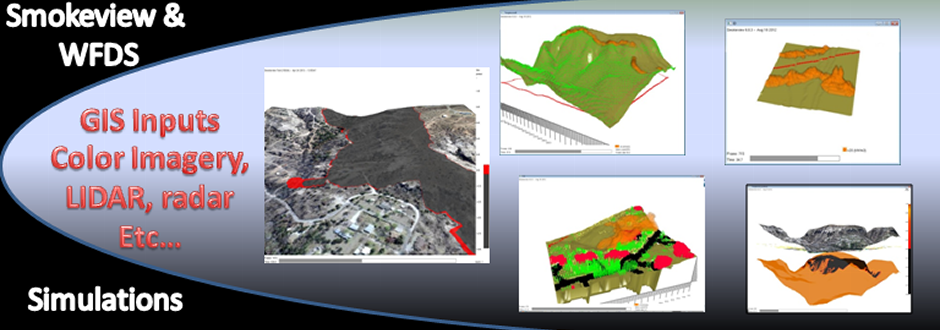
GMS was awarded a National Institute of Standards and Technology (NIST) Fire Research Grant to study the integration of GIS and Wildland-Urban Interface Fire Models to provide information to improve safety of homeowners and first responders as well as to increase protection to property.  Two years of a possible three year grant were awarded.  


6/01/12

GMS Staff Work Highlighted in Article

Work conducted by GMS Owner, Derek McNamara, was highlighted in a recent article.


©2013 Geospatial Measurement Solutions, LLC - 2149 Cascade Ave. Ste. 106A PMB 240 Hood River, OR 97031, USA  541-436-4486  dmgeo@gmsgis.com

Geospatial Technology, Development, Implementation and Maintenance Services.